
Walk an Oswego Street by Address
A sound Oswego street directory search moves from a physical address to a parcel identifier, then to records created for that parcel. The Oswego Township Assessor and Kendall County tax inquiry establish the present tax unit. Kendall GIS supplies map context and can expose document links. The Recorder then connects the land to grantors and grantees, the parties who transfer title. Voter and directory material may add evidence about people, but neither should be treated as a full household list.
- Enter the street number and name in the Oswego Township Assessor search. Limit the city to Oswego and save the PIN, the parcel identification number.
- Use the PIN in Kendall County GIS. Select the parcel and inspect the lots on each side, including condo units, outlots, and common parcels.
- Compare the current tax-year card in Kendall DevNet. Keep the owner, site address, mailing address, exemption, and effective year separate.
- Carry the legal description and PIN to the Kendall County Recorder. Follow each deed from the current grantee back to the prior grantor.
- For a past household, use dated newspapers, yearbooks, census material, and reverse-directory evidence. A full historical shelf belongs in the Oswego directory book.
The chain is strongest when every entry retains its source date. A recorded deed date does not establish a move-in date. An assessor owner may not occupy the site. A historic directory entry is evidence for its publication year, not for today.
Search Oswego Street Fields
The Oswego Township Assessor search is the practical first stop because its address form accepts a number range and a partial street name. There is no ZIP field. Choose Oswego from the city list because the township system also returns parcels in Aurora, Montgomery, Plainfield, and Yorkville. The begins-with option helps when the spelling is known; contains is useful for a longer street label.
| Search field | Input | Useful limit | Result order |
|---|---|---|---|
| Street number | From and to | Six characters each | PIN, address, or city |
| Street name | Text | 25 characters; begins with or contains | PIN, address, or city |
| City | Dropdown | Select Oswego for local results | Works with address fields |
| Owner | Name text | 35 characters; begins with or contains | PIN, owner, or city |
| Parcel | PIN text | Required; 18 characters maximum | Single parcel route |
The successful manifest capture of the assessor PIN search shows the stable parcel-key route used after an address has been found.
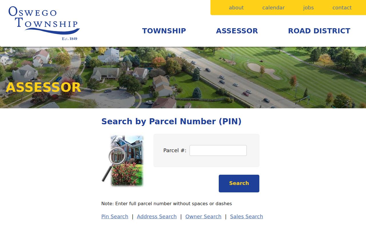
The form reinforces a key practice: save the PIN before moving between the assessor, tax card, GIS, and deed systems.
Read an Oswego Parcel Card
A parcel card gives more than a name. It can show the site address, owner and mailing address, subdivision, legal description, classification, dimensions, sale history, improvement facts, and yearly assessment. The 100 Parkers Mill sample card is an unusually clear check on careless assumptions.
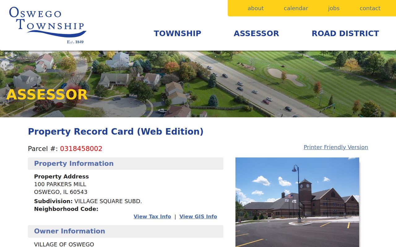
That municipal parcel has a valid PIN and legal description, a former building marked demolished, a prior sale, and zero current assessment lines because it is exempt. Zero value does not mean no parcel, and an owner line does not name every person present at the address.
- Parcel or PIN
- The stable identifier for a mapped tax unit.
- Situs address
- The physical location of the parcel, which may differ from the owner's mailing address.
- Plat
- A recorded map that divides land into lots, blocks, streets, or easements.
- Criss-cross directory
- A directory arranged by address or street rather than only by surname.
Oswego Records Keyed by Street
No single Oswego street directory names every person at every address. Each keeper indexes a different event or legal relationship. The best record depends on whether the question concerns title, tax status, a mapped lot, a permit, or a dated sign of residence.
| Address source | Local keeper | What it can establish | Access channel |
|---|---|---|---|
| Assessment card | Oswego Township Assessor | Owner, situs, legal description, class, sales, assessments | Free web search; assessor confirmation |
| Tax inquiry | Kendall County | Tax year, owner, site and mailing addresses, exemptions, taxing bodies | Free DevNet portal |
| Parcel map | Kendall County GIS | Parcel shape, adjacent parcels, layers, creating or retiring documents | Free viewer and open data |
| Land instrument | Kendall County Recorder | Grantor, grantee, document number, legal description, recording event | Paid Laredo account or Yorkville research room |
| Permit or code file | Village of Oswego | Project address, applicant, owner/customer, contractor, status | Targeted FOIA request |
The Kendall tax and address search supplies the tax-year layer that the township card alone cannot replace.
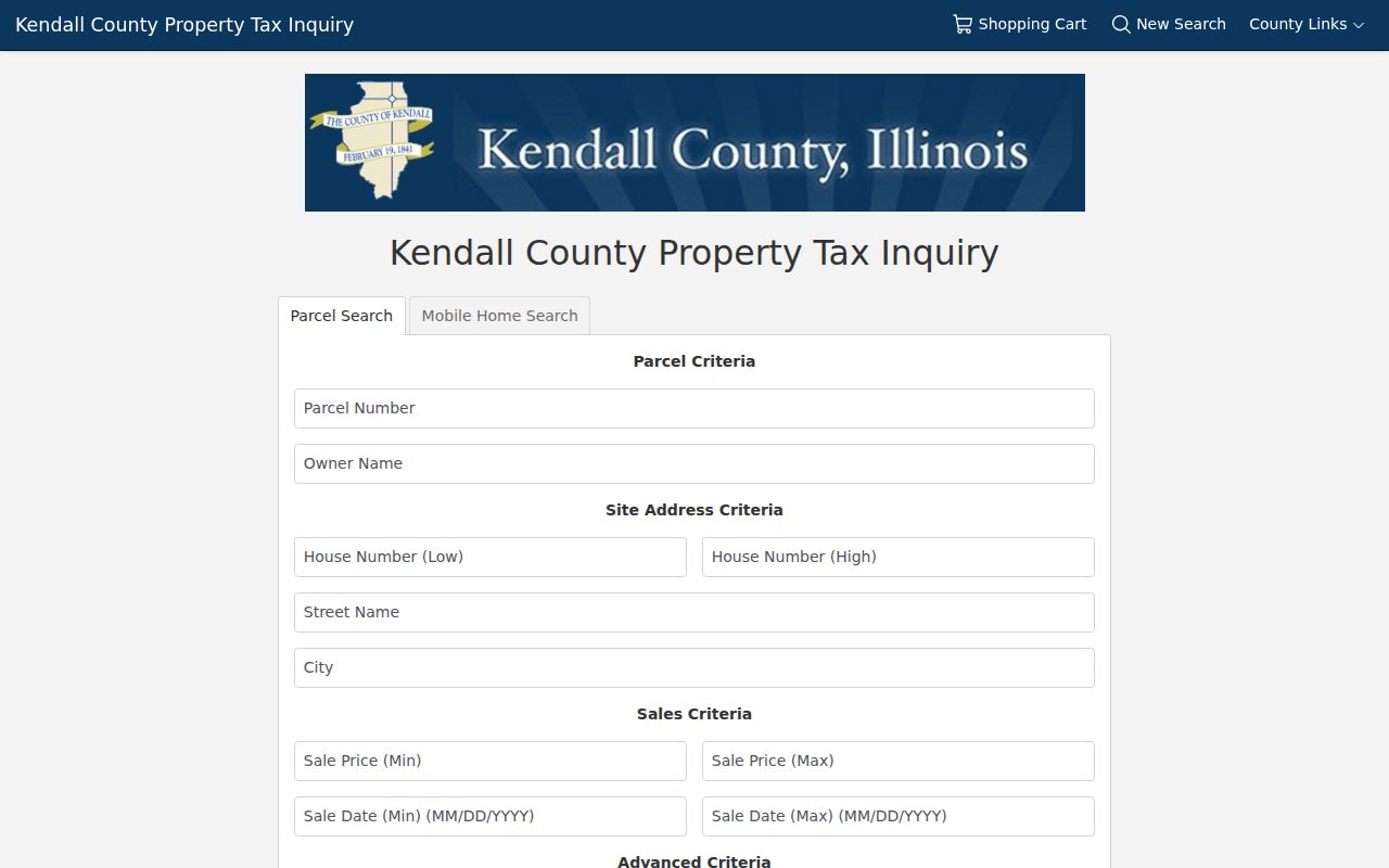
Its results should be read for the selected tax year, then cross-checked by PIN rather than matched only on a street spelling.
Cross-Check Oswego Tax Years
The Kendall DevNet parcel card can display tax years from 2007 through 2025 in the inspected interface. A selected year carries owner, site and mailing data, tax code, exemptions, sales, assessment, and taxing-body details. Those fields do not all describe the same moment. Keep the tax year beside every copied value, especially when a street directory worksheet spans sales or parcel changes.
The sample Kendall tax parcel demonstrates how PIN 0318458002 joins the county tax record to the township card.
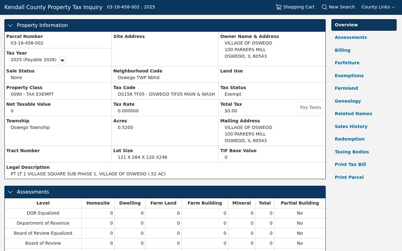
Using one PIN across systems avoids false matches caused by similar road names, mailing addresses, or a ZIP boundary.
Note: A homestead exemption may support owner-occupancy, but its absence never proves that no one lives at an Oswego parcel.
Map Oswego Parcels to Deeds
The Kendall County GIS viewer accepts a PIN with or without hyphens and a site address through autosuggest. Selecting a parcel updates its information panels. When shapes overlap, the selection tool can separate and page through them. Prior imagery, historic plats, parcel layers, and measurement tools help explain a former building or changed line, but GIS expressly is not a survey.
Some parcel metadata links a created or retired parcel to a recorded document, including document number, type, date, township, and old or new PIN. Carry that number to the Recorder. The official instrument, not the map layer, controls the deed evidence. Current Laredo remote access is paid, while the Recorder's Yorkville research area is available Monday through Friday from 8 a.m. to 4 p.m.; plats stop at 3 p.m.
This map-to-instrument handoff gives the Oswego street directory its strongest historical thread. Search the current grantee, then the prior grantor, and retain the legal description when a modern address is absent from an old instrument.
Follow Oswego Deeds Off-Screen
Remote access is only one route into the Kendall County deed record. The Recorder maintains a public research area at 502 South Main Street in Yorkville, and staff hours for document research run from 8 a.m. to 4 p.m. on weekdays. Plat work ends at 3 p.m. The office does not provide legal advice or perform a complete title search for the visitor, so arrive with a PIN, legal description, subdivision, likely party name, and any document number found in GIS or on a parcel card.
The June 2025 Laredo agreement describes paid remote access by minute tier, remote printing, print-only charges, and availability outside maintenance periods. It also warns that the online material is a working copy and may contain index errors. The research did not establish an exact remote historical start year. Do not assume an old Oswego instrument is absent merely because it fails to appear in the account search.
At the counter or in Laredo, record the grantor, grantee, instrument type, document number, recording date, book and page when present, legal description, and linked documents. Then reverse the parties: the current owner's deed names the prior grantor, who becomes the next search name. Mortgages, releases, liens, trustee instruments, plats, and annexation papers add context, but a deed chain tracks title parties rather than every resident along the street.
Measure Around an Oswego Street
Kendall County's public-notification workflow can build a list around one selected parcel. The user can select or drag an area, set a distance and units, then export a PDF or CSV. This is useful for finding parcels near a project site without pretending the export is a household roster.
The captured adjacent-parcel notification guide documents those controls and output choices.
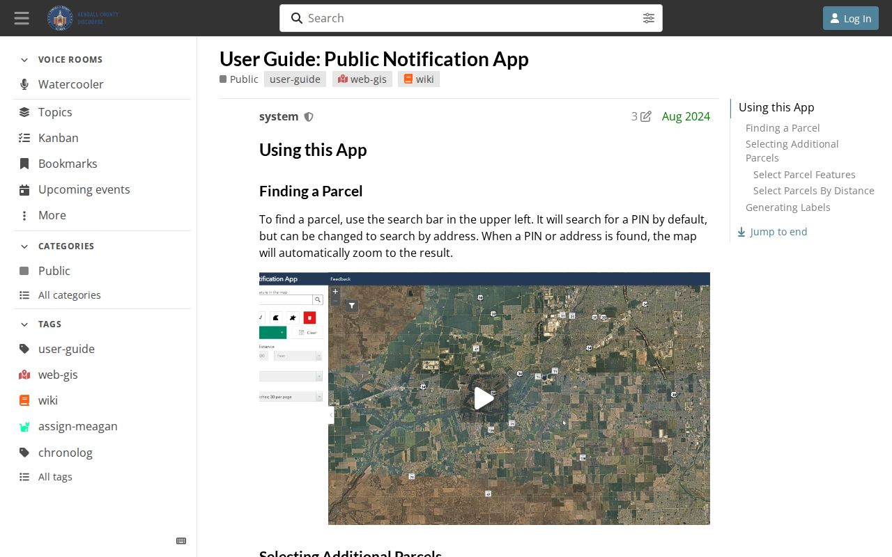
The resulting parcel list identifies mapped property interests. Condominiums, common areas, rights of way, and outlots may create more rows than visible houses.
Request Oswego Address Files
The Village has no public permit-case index. Use the Building and Permits office and the Village FOIA route when a known address needs a permit, inspection, certificate, ordinance case, or project file. A permit application may name the owner/customer, project address, subdivision and lot, contact, contractor, work type, cost, and status. An applicant is not automatically an occupant.
A zoning verification letter answers zoning questions, but the Village says it excludes violations, permits, certificates, inspections, and site plans. Ask separately for the exact excluded record. The current FOIA policy states a normal five-working-day response, with a possible five-day extension. Narrow requests by address, date range, record type, and any known permit or report number.
The Village crash and crime map adds only approximate, weekly updated geographic context. It omits personal data and sensitive events and discourages exact-address derivation. It is not a street directory and should never be used as one.
Oswego Streets Cross Record Borders
Oswego's official neighborhood and watch inventory names Original Town, downtown, many subdivisions, and the Route 34, Route 30, and Route 71 business corridors. Those labels are useful search terms for GIS, tax, newspaper, and Village requests. They do not define a private membership list. Development and annexation also mean the postal city, municipal line, subdivision name, and township record can describe different geographies.
USPS documents a 2009 delivery change in which two deliveries using 60543 moved to Aurora 60503. That kind of postal revision is not proof that land moved or that a resident changed homes. For an exact modern address, verify the ZIP through USPS, but use the parcel PIN and legal description for land records.
The same rule applies to old address phrases. Historical material may use a landmark, lot and block, subdivision, or metes-and-bounds description rather than today's number. Preserve the original wording and map it cautiously.
Limits of an Oswego Street Directory
Public property records identify owners and instruments, not a complete household. A mailing address can belong to a trust, company, government body, or owner who lives elsewhere. Renters and other household members are not collected in one open Oswego register. Utility customer and delivery data are not public street rosters. The Kendall voter lookup is a personal verification form, not a way to export every voter on a block.
Illinois protections can also reduce address visibility. The Address Confidentiality Program may shield an eligible participant's displayed voter address, though it cannot guarantee that older deeds or property records vanish. Treat absence as an access limit, not evidence that a person is gone.
Lawful use. Use Oswego address records for lawful personal research, property questions, family history, and civic review. Never use them to stalk, harass, threaten, or harm anyone.
Commercial neighbor tools often merge stale and unrelated data. Official rolls are narrower but disclose their keeper, date, and legal purpose. Verify each fact with the custodian and label owner, voter, permit applicant, and past directory entry as different relationships.