
Oswego ZIP Coverage at a Glance
Oswego's main postal clue is 60543. Research also found a 60560 edge case and a documented 60503 delivery change. These are postal facts, not a municipal boundary layer. USPS should validate the delivery line, while Kendall County and Village sources answer parcel and incorporation questions.
| ZIP Code | Areas Covered | Post Office | Notes |
|---|---|---|---|
| 60543 | Village core and much of the Oswego mailing area | Oswego Post Office | Primary last line; not proof of Village limits |
| 60560 | Oswego-area edge searches | Yorkville Post Office | Verify exact address, parcel, and boundary |
| 60503 | Two deliveries moved from 60543 in 2009 | Aurora delivery context | Historic route exception, not normal Oswego geography |
No official address-by-address municipal ZIP boundary file was located. That gap is important. Treat this table as a postal search frame, then verify any edge address through USPS, the assessor, GIS, and Village records.
Start With Oswego's 60543
The Oswego Post Office listing identifies 26 S Madison Street, Oswego, IL 60543-9998, with phone 630-554-8410. Its listed retail hours are Monday through Friday, 8:30 a.m. to 6 p.m., and Saturday, 8:30 a.m. to 3 p.m. Check the current listing before a visit.
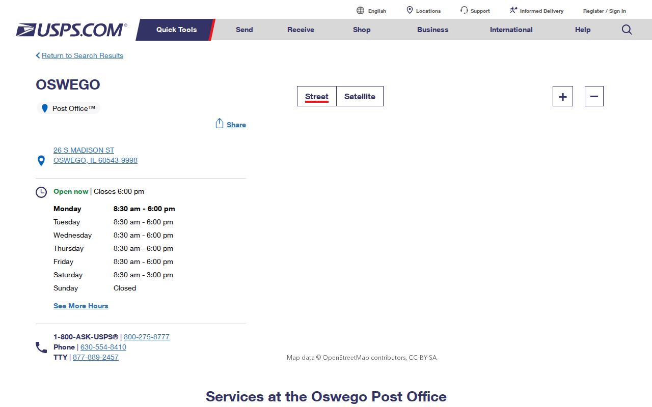
The facility confirms the main postal identity. Its street location does not mark the center or outer line of the Village.
Search Oswego Residents by ZIP
Not every Oswego portal accepts a ZIP code. USPS validates postal geography. IDFPR, I-Cash, and the Illinois offender registry offer ZIP fields for their narrow record types. The township assessor, Kendall tax inquiry, GIS, and voter self-lookup do not expose a direct ZIP filter in the inspected forms.
- Standardize the full street, unit, city, and state through the official USPS address lookup.
- Search the Oswego Township Assessor by city, house number, and street, then save the PIN.
- Cross-check that PIN in Kendall DevNet and GIS. Note situs, mailing address, subdivision, and legal description.
- Use a ZIP-enabled state portal only for its stated purpose, and label the result as a license, unclaimed-property, or registry record.
- Move to the Oswego street directory after the postal area narrows to a named street.
A ZIP-wide result is still broad. Match it to a name, parcel, file number, or another dated source before drawing a conclusion about an Oswego resident.
Oswego ZIP Search Fields Differ
The portals key their records in different ways. This is why the Oswego ZIP code directory cannot act as one master resident list.
| Portal | ZIP field | Best key | Meaning |
|---|---|---|---|
| USPS | Optional | Complete address | Postal standardization |
| Oswego Assessor | No | City, street, number, owner, PIN | Parcel assessment |
| Kendall DevNet | No | PIN, owner, address, tax year | Tax record |
| Kendall voter form | No | Name, birth data, house number | Individual registration check |
| IDFPR | Yes | Name, board, license, city, ZIP | Credential location |
| I-Cash | Yes | Name, city, ZIP, property ID | Possible state-held property |
A professional-license or unclaimed-property ZIP may be tied to an old, business, or mailing address. It is not proof of a present home.
The assessor's city filter is more useful than a guessed ZIP. Its address form supports number ranges, street name, match criteria, city, and sort order. Owner and sales searches add other routes. Kendall DevNet can search owner, house number, street, city, sales, tax code, district, and legal description, with tax years from 2007 through 2025 observed during research. Neither portal should be described as a ZIP-wide resident roll.
Check 60560 Oswego Addresses Twice
USPS label material groups 60543 and 60560 under an Oswego label context, yet Yorkville has its own 60560 post office. The Yorkville Post Office listing identifies the facility at 115 S Main Street. An Oswego-area search that returns 60560 needs an exact-address check instead of a forced city label.
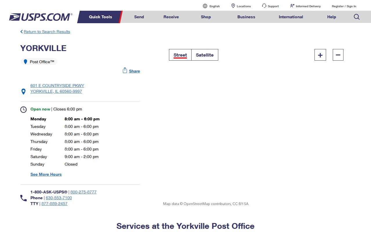
Follow the postal check with the PIN, GIS parcel, and Village boundary material. That separates a mailing convention from the government with authority over the land.
Postal Labels Are Not Oswego Borders
The USPS L007 label material effective August 1, 2025 groups the two postal codes for mailing operations.
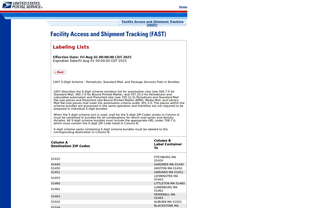
The label rule helps sort mail. It does not establish an incorporated-place boundary, parcel owner, or resident.
The 2009 Oswego ZIP Change
USPS documented a small but useful exception. Effective February 14, 2009, two deliveries formerly assigned to 60543 moved to Aurora 60503. An old envelope and a current database can therefore disagree without the person or parcel having moved.
The 2009 Postal Bulletin records the delivery realignment.
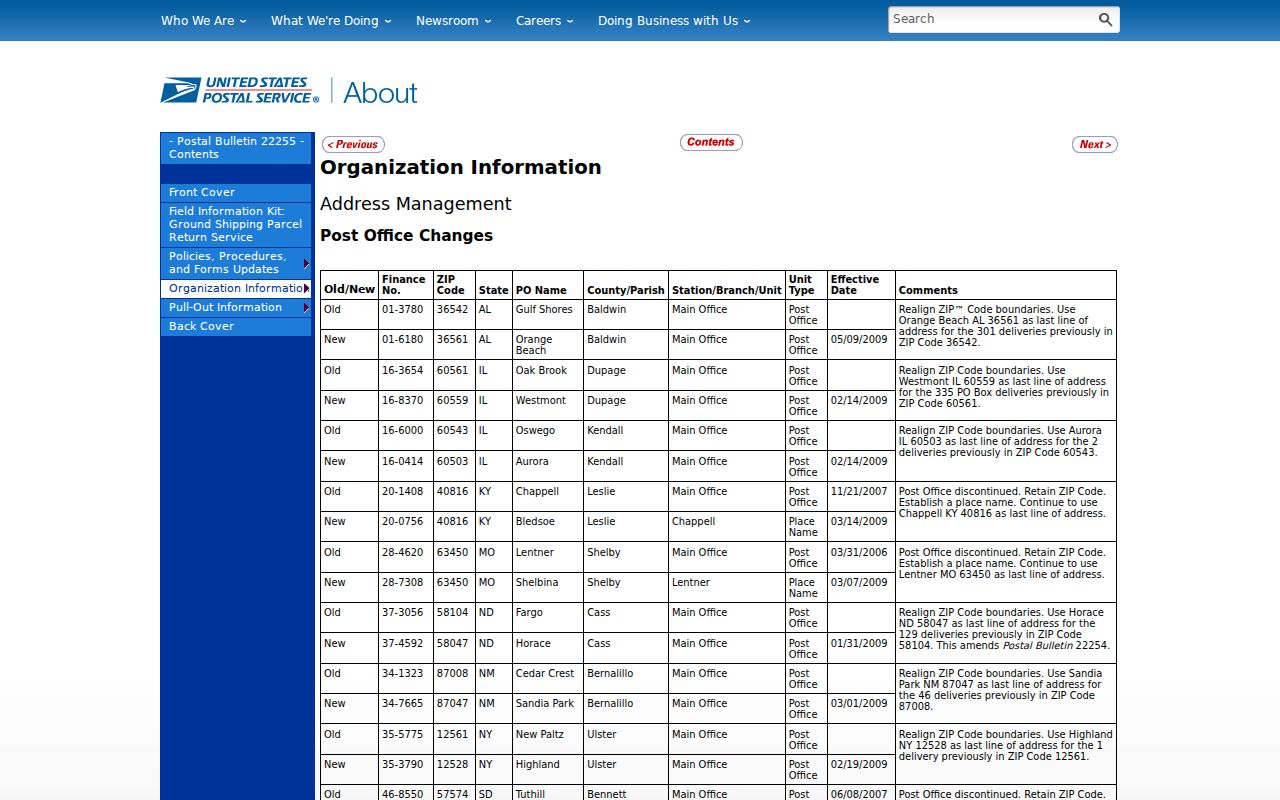
Keep the date and source with any historic address note. Do not silently replace the old ZIP in a deed, directory, or family file.
Oswego ZIPs Versus Village Limits
A ZIP code describes USPS delivery geography. The Village line describes local government. Kendall GIS parcel geometry, the Village zoning map, and annexation records provide other views. Annexation materials ask for the address, PIN, legal description, distance from the Village boundary, and nearby-property notice details. Those fields show why an Oswego postal line cannot settle municipal status.
- ZIP versus ZIP+4
- A ZIP is the five-digit delivery area. ZIP+4 adds a more precise delivery segment.
- PO-box ZIP
- A code used mainly or only for post-office boxes, not a general land boundary.
- Unique ZIP
- A code assigned to one high-volume organization rather than a broad neighborhood.
- Carrier route
- The group of addresses served on one postal delivery route.
Use the PIN as the county crosswalk. Kendall systems may show it as 03-18-458-002 or 0318458002. The same key can connect an assessor card, tax record, GIS selection, and recorded-document research without asking the ZIP to do a parcel's job.
Situs and mailing addresses also need separate labels. The situs address is the physical parcel location used by assessor and GIS systems. The mailing address is where the owner receives tax notices, and it may sit outside Oswego. A legal description identifies land by lot, block, subdivision, or metes and bounds. Those three fields can disagree with the postal city while still describing the same parcel.
Older Oswego Addresses Before ZIPs
Early Oswego sources often describe place by landmarks. The 1852 business directory used phrases such as “opposite National Hotel” and “two doors south of post office.” Later annexation and growth spread development west across the Fox River and toward Routes 34, 30, and 71. Neither clue should be forced into a modern ZIP without more evidence.
For an old address, preserve the wording and year. Compare a plat or historic map with the current street shape, then locate the legal description or PIN. USPS can standardize a current delivery address, but it cannot translate a nineteenth-century landmark into a proven modern parcel.
Oswego's growth adds another layer. Official Village history describes annexation waves from the mid-1980s through the early 2000s, followed by expansion west across the Fox River and north and east toward U.S. 30. A subdivision name can help locate a parcel in that development history, but it does not prove one postal code or an incorporation date. Use the official neighborhood vocabulary as a search term, then verify the parcel.
Label Every Oswego ZIP Result
A careful ZIP code directory keeps postal, parcel, and person evidence apart. USPS can confirm a standardized delivery line. The assessor can show an owner and situs. DevNet can show the selected tax year and mailing fields. GIS can place the parcel among roads and nearby parcels, but its disclaimer says the map is not a survey. A voter self-check can confirm an individual's registration context when the required identity fields are supplied.
Write down the source and date with each result. “60543 on a 2008 envelope,” “60503 in the current USPS result,” and “Oswego situs on the 2025 tax card” can all be accurate statements about one research trail. Flattening them into “the resident moved” would not be supported. The documented 2009 delivery realignment shows exactly why those labels matter.
The same rule protects edge searches involving 60560. First record the USPS last line. Next capture the PIN and legal description. Then inspect Kendall GIS and Village annexation or zoning material. If the sources do not settle the municipal line, state that limit plainly instead of assigning the address to Oswego from the ZIP alone.
Current online sources also carry different dates. The tax portal exposes a tax-year selector, GIS parcel layers may reflect a newer geometry, and the USPS result describes current delivery. A deed or old newspaper preserves the address as it was recorded then. Keep each date instead of replacing all older labels with today's ZIP.
For a resident search, a postal code is a filter, not an identity key. Two people in 60543 still need a name variant, parcel, license number, case number, or other dated fact to tell them apart. Conversely, the same person may appear with 60543, 60560, or a non-Oswego mailing ZIP in different official records. The record's stated relationship determines what the match means.
This source-by-source method keeps the Oswego ZIP code directory useful without turning postal geography into a claim that the underlying records cannot support.